


Punta l'iPhone sul mondo — dal finestrino dell'aereo o da una collina — e CitySpotter riconosce le città che puoi davvero vedere. In realtà aumentata, completamente offline.
Point your iPhone at the world — from a plane window or a hilltop — and CitySpotter names the cities you can really see. In augmented reality, fully offline.
Da 11.000 m al livello del mare, CitySpotter dà un nome a ogni città lungo la discesa. From 11,000 m down to sea level, CitySpotter names every city on the way.
Le altre app mostrano tutte le città nel raggio. CitySpotter conosce la forma del terreno: se una montagna nasconde una città, quella sparisce dalla vista.
Other apps show every city in range. CitySpotter knows the shape of the land: if a mountain hides a city, it disappears from view.


Screenshot reali — lungomare di Piombino, guardando l'Isola d'Elba. Toccando Terreno 3D, 4 città spariscono: sono dietro i crinali dell'Elba, e non potresti vederle. Real screenshots — Piombino seafront, looking towards the Isle of Elba. Tap 3D Terrain and 4 towns vanish: they sit behind Elba's ridges, where you couldn't see them.
Un'app bussola mostra tutte le città nel raggio, anche quelle sepolte dietro una montagna. Finisci a fissare una collina cercando una città che non c'è.
A compass app shows every city in your radius, even the ones buried behind a mountain. You end up staring at a hillside looking for a town that isn't there.
Porta con sé un modello reale di colline e montagne e verifica la linea di vista verso ogni città. Se un crinale si mette in mezzo, l'etichetta sparisce — perché non puoi vederla.
It carries a real model of hills and mountains and checks the line of sight to every city. If a ridge stands in the way, the label disappears — because you can't see it.
Ogni viaggiatore se l'è chiesto. Metti la modalità aereo, punta l'iPhone fuori dal finestrino e CitySpotter risponde: etichette in tempo reale sulle città là sotto, con le distanze, anche in quota di crociera. Senza internet, senza roaming, senza tirare a indovinare.
Every traveller has wondered. Switch to airplane mode, point your iPhone out the window and CitySpotter answers — live labels on the cities below, with distances, even at cruising altitude. No internet, no roaming, no guessing.
Clip reale dal finestrino, in quota: le città là sotto, etichettate dal vivo. Real clip from the window seat at cruising altitude: the cities below, labelled live.
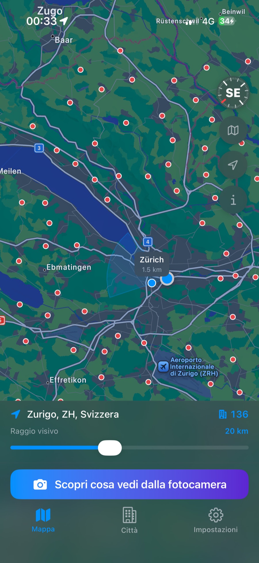
Screenshot reale — Zurigo: 136 città nel raggio di 20 km. Real screenshot — Zürich: 136 towns within 20 km.
Scarica una volta il pacchetto di un paese — città e terreno inclusi. Da lì in poi CitySpotter vive interamente sul tuo iPhone: su una vetta senza segnale o a 11.000 m con tutto spento. Gratis, senza pubblicità e senza account.
Download a country pack once — cities and terrain included. From then on CitySpotter lives entirely on your iPhone: on a summit with no signal, or at 11,000 m with everything switched off. Free, with no ads and no account.
«Funziona perfettamente in aereo senza utilizzare i dati e quando la connessione è assente aiuta ad orientarsi. Utilissimo anche per vedere quali città abbiamo intorno e quanto distano.» “Works perfectly on a plane without using any data, and when there's no signal it helps you get your bearings. Great for seeing which cities are around you and how far away they are.”
Completamente. Città e terreno vivono sul telefono dopo un solo download.
Completely. Cities and terrain live on your phone after a one-time download.
Leggi →Read more →Città fino a 120 km, etichettate attraverso il finestrino — in modalità aereo.
Cities up to 120 km away, labelled through the window — airplane mode on.
Leggi →Read more →Ha un modello 3D reale del terreno e verifica la linea di vista verso ogni città.
It carries a real 3D model of the terrain and checks the line of sight to every city.
Leggi →Read more →CitySpotter è un'app gratuita per iPhone (iOS 17+) — Android in sviluppo — che identifica in realtà aumentata le città visibili dall'orizzonte a partire dalla posizione GPS dell'utente, sia da terra sia dal finestrino di un aereo fino a 11.000 m di quota (funziona in modalità aereo). A differenza delle app bussola tradizionali, CitySpotter usa una mappa reale delle colline e montagne per capire se c'è qualcosa in mezzo tra te e ogni città — se c'è, quella città non compare. Il database comprende oltre 29.000 città in 6 paesi — Italia, Francia, Germania, Spagna, Austria e Svizzera — con Regno Unito, Portogallo, Paesi Bassi, Belgio, Grecia e Stati Uniti in arrivo (fonte: GeoNames, CC BY 4.0). L'app funziona completamente offline: nessuna connessione internet richiesta, nessun dato personale raccolto.
CitySpotter is a free iPhone app (iOS 17+) — Android in development — that identifies in augmented reality the cities visible on the horizon from the user's GPS position, both from the ground and from an airplane window at up to 11,000 m of altitude (works in airplane mode). Unlike traditional compass apps, CitySpotter uses a real map of hills and mountains to check whether something blocks the view between you and each city — if it does, that city doesn't appear. The database includes over 29,000 cities across 6 countries — Italy, France, Germany, Spain, Austria and Switzerland — with the United Kingdom, Portugal, the Netherlands, Belgium, Greece and the United States on the way (source: GeoNames, CC BY 4.0). The app works completely offline: no internet connection required, no personal data collected.
Una sola email quando CitySpotter arriva su Google Play. Nient'altro, mai.
One email when CitySpotter lands on Google Play. Nothing else, ever.
Niente spam, niente newsletter. Oppure scrivi a info@cityspotter.app No spam, no newsletter. Or write to info@cityspotter.app


